8 Inches Of Snow Could Slam Parts Of North Jersey, NWS Says In Latest Update 8 Inches Of Snow Could Slam Parts Of North Jersey, NWS Says In Latest Update
8 Inches Of Snow Could Slam Parts Of North Jersey, NWS Says In Latest Update The National Weather Service (NWS) in Mount Holly has expanded Winter Storm Warnings to include all of southeastern Pennsylvania and portions of central New Jersey.  The forecast has trended colder and snowier, with 6 to 9 inches of snow expected north and west of the I-95 corridor, including Philadelphia. Residents are also being warned of dangerously cold conditions that could pose significant risks through midweek (see snow map above and winter weather advisories below). Sunday Storm Forecast: Widespread snow will move into the region late Sunday morning, Jan. 19 into the early aft…
Murphy Declares State Of Emergency, New Snowfall Forecast Released As Winter Storm Nears Murphy Declares State Of Emergency, New Snowfall Forecast Released As Winter Storm Nears
Murphy Declares State Of Emergency, New Snowfall Forecast Released As Winter Storm Nears New Jersey Gov. Phil Murphy declared a State of Emergency beginning Sunday morning, Jan. 19, right as the National Weather Service released a brand-new snowfall forecast for the winter storm heading toward the region. CLICK HERE FOR LATEST FORECAST AS OF 9 AM JAN. 19, 2025. The storm will begin with scattered showers and a low of 26 degrees Saturday night, Jan. 18, the NWS said. By Sunday afternoon, snow is expected to begin after 1 p.m., with temperatures hovering around 30 degrees. The snow could be heavy at times, with rates exceeding 1 inch per hour, especially in areas northwest of the…
Arctic Blast Will Follow Snow Showers Across NJ With Temps We Haven't Seen In Years, NWS Says Arctic Blast Will Follow Snow Showers Across NJ With Temps We Haven't Seen In Years, NWS Says
Arctic Blast Will Follow Snow Showers Across NJ With Temps We Haven't Seen In Years, NWS Says Light snow showers are forecast to begin Thursday afternoon, Jan. 16 across parts of New Jersey and Pennsylvania, potentially creating slippery conditions during the evening commute, according to the National Weather Service (NWS).  A Hazardous Weather Outlook has been issued for several northeast New Jersey counties, including Passaic, Hudson, Bergen, Essex, and Union, with snowfall set to begin after 4 p.m. Most areas are expected to see less than one inch of snow, though localized accumulations of up to two inches are possible in parts of eastern Pennsylvania near and north of …
40 MPH Winds, Cold Temps: Here's Your New Jersey Forecast 40 MPH Winds, Cold Temps: Here's Your New Jersey Forecast
40 MPH Winds, Cold Temps: Here's Your New Jersey Forecast New Jersey residents are bracing for a cold and windy day on Tuesday, Jan. 7, with high temperatures barely reaching freezing across the state, according to the National Weather Service (NWS) in Mount Holly. Daytime highs are expected to range from 28°F in Wantage to 33°F along the Jersey Shore in towns like Long Branch and Atlantic City. Inland areas, including Trenton, Flemington, and Vineland, will see highs of about 31°F to 32°F. Adding to the challenges, 1,113 Sussex County residents were without power as of 9:22 a.m., according to local reports. The outages include: Branchville: 448…
6 To 8 Inches Of Snow Could Fall In Parts Of NJ, PA: Here's The Latest Winter Storm Forecast 6 To 8 Inches Of Snow Could Fall In Parts Of NJ, PA: Here's The Latest Winter Storm Forecast
6 To 8 Inches Of Snow Could Fall In Parts Of NJ, PA: Here's The Latest Winter Storm Forecast The first significant snowstorm of 2025 is expected to hit the region Sunday night, Jan 5, bringing up to 8 inches of snow to parts of New Jersey and Pennsylvania, according to the National Weather Service. The storm is expected to begin late Sunday night, continuing through Monday, Jan. 6 before tapering off into Monday night.  Snow accumulations are forecast across the region, with the highest totals predicted in South Jersey (Vineland, Atlantic City, Cape May) and Philadelphia, where snowfall could reach 6 to 8 inches, new weather maps show.  Greater Philadelphia could see 3 t…
Tornado? 'Freight-Train-Like Noise' Prompts Investigation In South Jersey Town Tornado? 'Freight-Train-Like Noise' Prompts Investigation In South Jersey Town
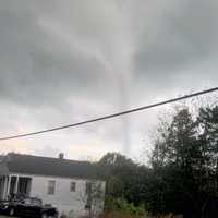
Tornado? 'Freight-Train-Like Noise' Prompts Investigation In South Jersey Town Severe weather swept through a South Jersey town on New Year’s Day, leaving behind downed trees, damaged fences, and deck destruction late Tuesday, Dec. 31. Multiple 9-1-1 callers described hearing a “freight train-like noise” as high winds caused brief power outages and property damage in Clayton near Fries Mill Road, according to Gloucester County Emergency Management. While no injuries have been reported, residents were left shaken by the unexpected storm activity. The National Weather Service in Mount Holly has been contacted to determine whether the damage was caused by a tornado…
Freezing Rain To Glaze Roadways With Ice: Winter Weather Advisories Issued Across NJ, PA Freezing Rain To Glaze Roadways With Ice: Winter Weather Advisories Issued Across NJ, PA
Freezing Rain To Glaze Roadways With Ice: Winter Weather Advisories Issued Across NJ, PA A Winter Weather Advisory has been issued for parts of New Jersey and Pennsylvania as freezing rain is expected to create icy road conditions Friday night, Dec. 27 into Saturday morning, Dec. 28, according to the National Weather Service (NWS). The advisory is in effect from 7 p.m. Friday to Saturday. Ice accumulations of up to one-tenth of an inch are anticipated in Sussex, Warren, and Morris counties, in NJ, and Lehigh and Northampton counties, in PA. "Very slippery sidewalks, roads, and bridges are possible," the NWS warned. Motorists are urged to slow down and exercise caution while dri…
3.4 Inches Of Snow Fell In Parts Of Union County: Here's How Much Your Town Got 3.4 Inches Of Snow Fell In Parts Of Union County: Here's How Much Your Town Got
3.4 Inches Of Snow Fell In Parts Of Union County: Here's How Much Your Town Got A winter storm dropped varying amounts of snow across New Jersey overnight Friday, Dec. 20, into Saturday morning, Dec. 21.  Snowfall totals ranged from trace amounts in South Jersey to more than 5 inches in parts of North Jersey, creating slippery conditions on roadways as temperatures remained below freezing, according to data from the National Weather Service. Sussex and Morris counties recorded the highest snowfall, with Sparta Township leading at 5.5 inches and Randolph Township close behind at 5.3 inches. Meanwhile, southern counties like Atlantic and Cumberland reported only tra…
1 To 3 Inches Of Snow Expected This Weekend In Parts Of NJ, PA: Here's Your Forecast 1 To 3 Inches Of Snow Expected This Weekend In Parts Of NJ, PA: Here's Your Forecast
1 To 3 Inches Of Snow Expected This Weekend In Parts Of NJ, PA: Here's Your Forecast A weak winter system is expected to bring a mix of light snow and rain to parts of New Jersey and Pennsylvania beginning Friday morning, Dec. 20, and lasting into early Saturday, Dec. 21, the National Weather Service (NWS) in Mount Holly said. A weak system will move through Friday into early Saturday morning, bringing a mixed bag of wintry weather across the... Posted by US National Weather Service Philadelphia/Mount Holly on Thursday, December 19, 2024 The Poconos and northwest New Jersey are expected to see the most snow, with accumulations ranging from 1 to 3 inches. Areas north…
What Are Snow Squalls? Winter Weather Hazard Forecast In NJ, PA: Here's What To Know What Are Snow Squalls? Winter Weather Hazard Forecast In NJ, PA: Here's What To Know
What Are Snow Squalls? Winter Weather Hazard Forecast In NJ, PA: Here's What To Know A storm system moving in brings the potential for snow squalls, 55 mph winds, and frigid temps mid-week in New Jersey and Pennsylvania, forecasters have said in a new update. ⚠️❄️🌬️ Not much change to the forecast for tonight through Thursday. Some snow showers may result in some light... Posted by US National Weather Service Philadelphia/Mount Holly on Wednesday, December 4, 2024 A powerful cold front is set to sweep through the region tonight into Thursday, Dec. 5, bringing snow showers, potential travel hazards, and wind gusts as high as 55 mph, according to the National Weather …
Brace For Impact: Snow, Gusty Winds To Sweep Through New Jersey Brace For Impact: Snow, Gusty Winds To Sweep Through New Jersey
Brace For Impact: Snow, Gusty Winds To Sweep Through New Jersey A powerful cold front is set to move through the region mid-week, bringing light snow and widespread gusts of 40-50 mph, with higher totals in some areas, according to the National Weather Service (NWS). The storm is expected to bring rain and snow showers starting Wednesday night, Dec. 4, with minor snowfall accumulations possible through Thursday morning. Most areas in New Jersey will see less than one inch of snow, while higher elevations in northern counties, such as Sussex and Morris, could receive up to two inches. The bigger concern is the strong winds forecasted for Thursday morning…
Rain, Winds, Coastal Storm? What NJ Can Expect From The Weather This Thanksgiving Week Rain, Winds, Coastal Storm? What NJ Can Expect From The Weather This Thanksgiving Week
Rain, Winds, Coastal Storm? What NJ Can Expect From The Weather This Thanksgiving Week The National Weather Service in Mount Holly is forecasting a mix of sunny skies, mild temperatures, and rain chances this Thanksgiving week, with a potential coastal storm expected to impact travel plans Thursday into Friday. Here's your day-by-day forecast this week through the holiday, according to the NWS: Sunday, Nov. 24: Expect mostly sunny skies with a high near 56°F. West winds will blow around 15 mph, with gusts as high as 30 mph. Tonight will be partly cloudy, with lows dropping to 33°F and calming winds. Monday, Nov. 25: Sunny and slightly warmer, with a high near 59°F.…